Natural hurricane protection
Coastal wetlands play a key role in helping to reduce impacts from storm surges on coastal communities. A report released by the Army Corps of Engineers in 1963 showed that every 2.7 miles of wetlands can create a buffer against 1 foot of storm surge. Wetlands can be an effective means of protecting lives and property.
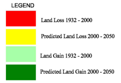
100 years of land loss
Coastal Louisiana has lost an average of 34 square miles of wetlands per year for the last 50 years. This totals 1,900 square miles of land lost from 1932 to 2000, roughly an area the size of the landmass of Delaware. These losses are due to erosion, subsidence, and development including the construction of levees on the Mississippi River.
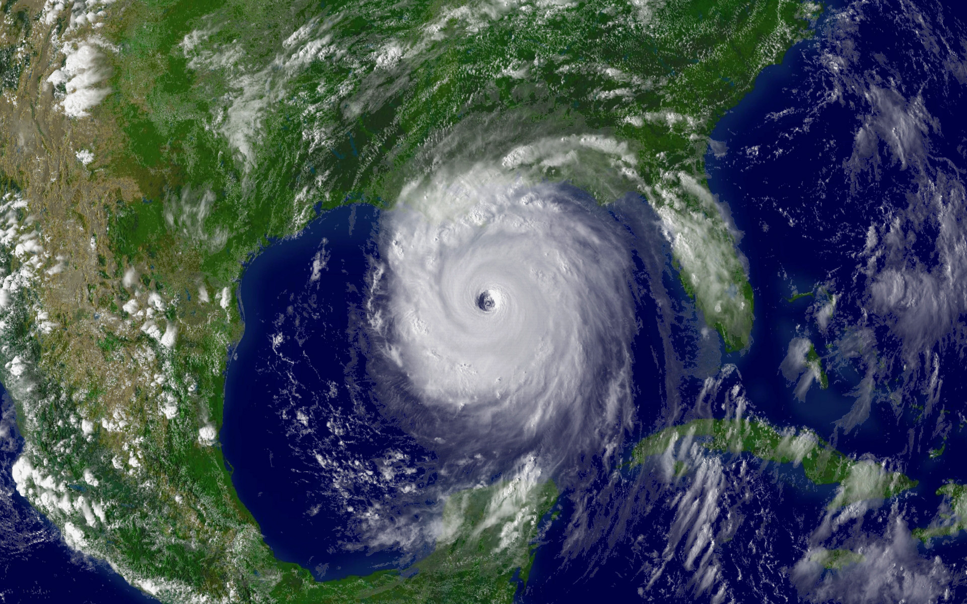
Hurricane Katrina swept over Louisiana's vast coastal wetland complex before striking land along the coastal communities of Louisiana, Mississippi, and Alabama. More than 40 miles of forested wetlands, marsh, and barrier islands once buffered the New Orleans metropolitan area, but this natural protection has been lost over decades. This led to further infrastructure damage during Katrina.
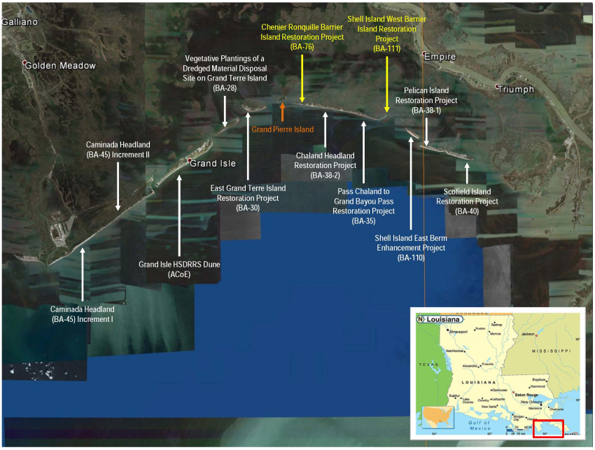
view full-resolution map
Isles Dernieres: a case study in land loss
As recently as 150 years ago, the islands of Isles Dernieres in the Terrebonne Basin were attached to the mainland. Local lore notes that a horse could be ridden to the island. But the Great Storm of 1856, or the Last Island Hurricane, severed Isle Derniere in two and removed any remaining connection to the mainland.
After the connection to the mainland was lost and inland wetlands started to disappear, the islands became more isolated, large volumes of water moved through the channels with each tidal cycle, further eroding the island’s banks. Waves that washed over the islands began to spread their sands across bays and sounds, causing the islands to eventually sink below the water’s surface. The islands no longer served as a buffer to storm surges or as habitat to fish, birds, and mammals.
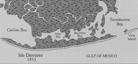
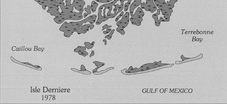
Adapted from: Williams Et. al., U.S. Geological Survey Circular 1075
Reversing the trend: rebuilding barrier islands
This doesn't have to be the end of the story— beaches, dunes, and marsh habitat can be rebuilt. NOAA has taken a lead role in designing and constructing restoration of Louisiana's barrier islands, with a particular focus on the islands of the Barataria Basin.
Since most of the islands have not been developed, we are able to re-create the entire habitat from the beaches of the Gulf of Mexico. Sand and mud is harvested from offshore or renewable sources in the Mississippi River using a hydraulic dredge. The sand and mud is pumped dozens of miles away to be shaped into new habitat where barrier islands once existed.

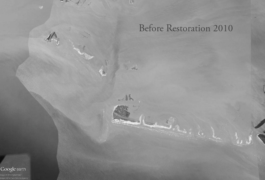
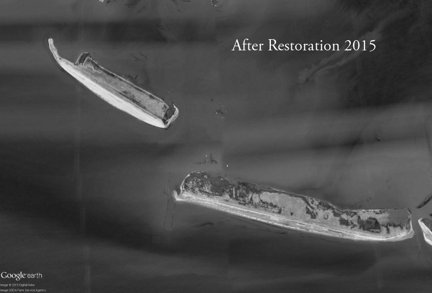
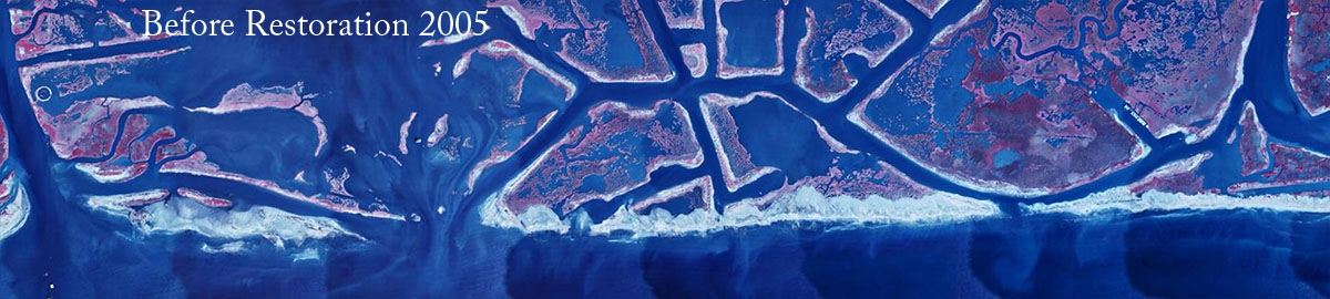
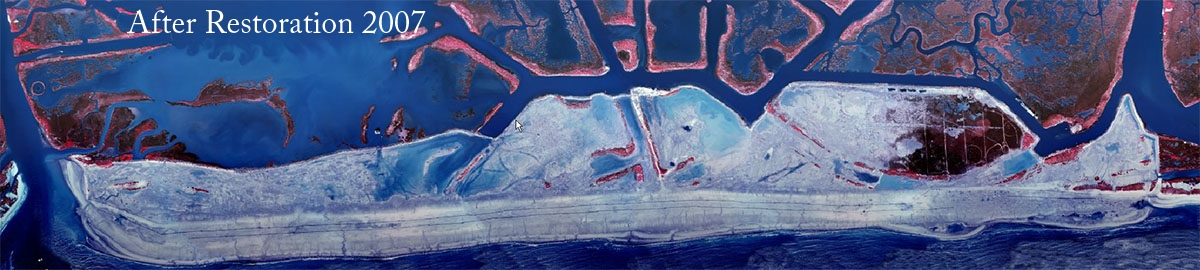
Restoring Pelican and Shell islands
Here we see the restoration of two adjacent islands—Shell Island East and Pelican Island. For Pelican Island (on the right), NOAA worked with partners to restore 540 acres using three million cubic yards of sediment hydraulically dredged from 9 miles offshore. By 2012, we completed the project and successfully recreated 2.54 miles of valuable beach/dune habitat.
Today, its neighbor Shell Island East has also been given new life through a similar project implemented by Louisiana's Coastal Protection and Restoration Authority. 1.66 miles of beach/dune habitat were restored using 2.5 million cubic yards of fill harvested from the Mississippi River.
Restoring the Chaland headlands
Throughout the coast of Louisiana, harvested sediment is also giving new life to barrier headlands. Headlands are a narrow piece of land that form the border between land and sea. Unlike barrier islands, headlands are connected to larger inland land masses. Using the same methods to restore Pelican and Shell Island, we re-established the Chaland headlands, which will help to provide protection to the valuable marsh habitats that lay just inland.
Providing regional protection
More than 36 miles of barrier shoreline have been restored in the Barataria Basin by NOAA and our partners, with more than four more miles slated for construction soon. In all, 9.6 million cubic yards of material will be used—enough to fill the Louisiana Superdome seven times! The Barataria Basin is better positioned to provide coastal resilience in the face of future storms and sea level rise thanks to these efforts.
view full-resolution map
Funding for NOAA-led projects was provided by the Coastal Wetlands Planning, Protection and Restoration Act, or CWPPRA.
Learn more about barrier island restoration